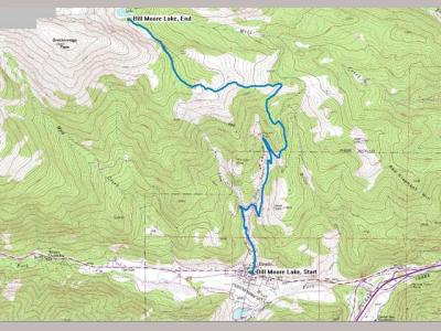
Bill Moore Lake ...
The Bill Moore Lake trail takes off north out of Empire and is actually one of a network of trails in that area. This is a nice, mild trail and is suitable for a stock Mitsubishi Montero or Montero Sport. This trail is rated a 3 out of 5.
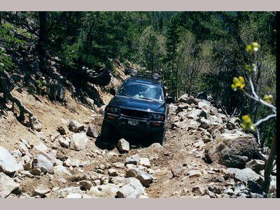
A steep, loose gravel hill reached just about two thirds of the way to Bill Moore Lake is the only serious obstacle and requires A/Ts or M/ts and either a lot of articulation, lockers or both. Luckily for most, this obstacle has a bypass. As you reach timber line you will leave the trees and turn left up a steep dirt hill. When you reach the top of the hill the main trail turns left again and you begin the approach to the gravel hill. The bypass heads west at this point and reenters the trees, circling to the north around the gravel hill.
The Bill Moore Lake trail, like much of the trails around the area is actually part of a network of trails. The trails are poorly marked or not marked at all so having a couple good topographical maps along is wise. If you are new to this trail it is strongly recommended that you travel this trail durring the day. With the dense forest, miles of trail and lack of signage it's easy to get lost and end up spending the night.
Many of the other trails are also traversable by stock or near stock Monteros or Montero Sports as well as other narrow vehicles. Wide, long wheel base vehicles have no place here. Some of the trails have VERY narrow, tree lined, off camber spots where it's necessary to shimmy between trees while making a tight turn and navigating large rocks. There are also one or two large rock obstacles. Body and under carriage damage is very possible on stock and near stock vehicles.
The Bill Moore Lake trail has several off shoots in the first one third of the trail. None of these, such as Hummer Hill, are suitable for non-modified vehicles.
High ground clearance, agressive 33"+ off road tires and at least one locker are recommened. These off shoots are VERY narrow and there's no way to turn around or pass another vehicle. If you can only get half way it will be necessary to back all the way out. Backing up uphill will almost certinly be impossible. Traffic is bi-directional so always make sure it's clear of vehicles before starting up or down.
This is a popular trail in the late fall after the first snows and before the Forest Service closes it for the season. Several sections of the trail are off camber which makes it very easy to slide off. If it's snowy and or icy use caution. Until you reach timber line much of the trail is on the north side and overshadowed by dense forest. This means that snow blows and drifts on much of the trail and as it melts quickly turns to solid ice. Snowdrifts frequently have a few inches of snow covering what is effectivly an 'ice drift'. These are dangerous because you will have NO lateral traction at all even with tire chains.
As you reach the last few hundred yards of trail you will decend a very steep, narrow section down to the level of the lake. While steep, this section is easily traversable by stock and near stock vehicles when dry. When covered in snow, however, this section becomes impassable even to heavily modified 'crawlers'.
Note, this trail is closed by the Forest Service durring the winter and spring. It usually opens back up in late May or early June.

